


Small Home Gazette, Spring 2016
Find Historic Aerial Photos of Your Bungalow
By now, it’s a near certainty that every homeowner has used Google Maps or some other online mapping service to view aerial photos of his or her home. It’s fascinating—there’s something godlike about viewing one’s domicile from hundreds of feet above the Earth.
Wouldn’t it be cool if Google Maps had a “turn back time” dial that would allow you to see what your house looked like shortly after it was built? Or even see what your block looked like before it was built?
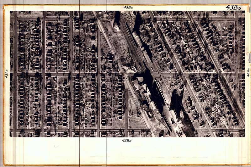
A 1938 aerial map from the University of Minnesota’s Borchert Map library, showing the section of south Minneapolis where I live. The diagonal band is Hiawatha Avenue, lined with grain elevators. The cross streets are 34th, 35th and 36th streets.
Now you can, in a way. Though we tend to think of aerial photography as a modern invention, it has been around since the first cameras appeared and someone took one up in a hot air balloon. And thanks to the University of Minnesota’s Borchert Map Library, it’s now relatively easy to find aerial photos of Minneapolis neighborhoods from 1938 and onward, and of Saint Paul neighborhoods from 1923 onward. (The Star Tribune reportedly has 1922 aerial photos of Minneapolis still squirreled away somewhere.)
The Minnesota Historical Aerial Photographs Online can be viewed at www.lib.umn.edu/apps/mhapo. But before you go searching for an aerial photo of your house, you should lower your expectations. Early 20th century photography was not as sophisticated as today’s, so the images tend to be rather muddy.
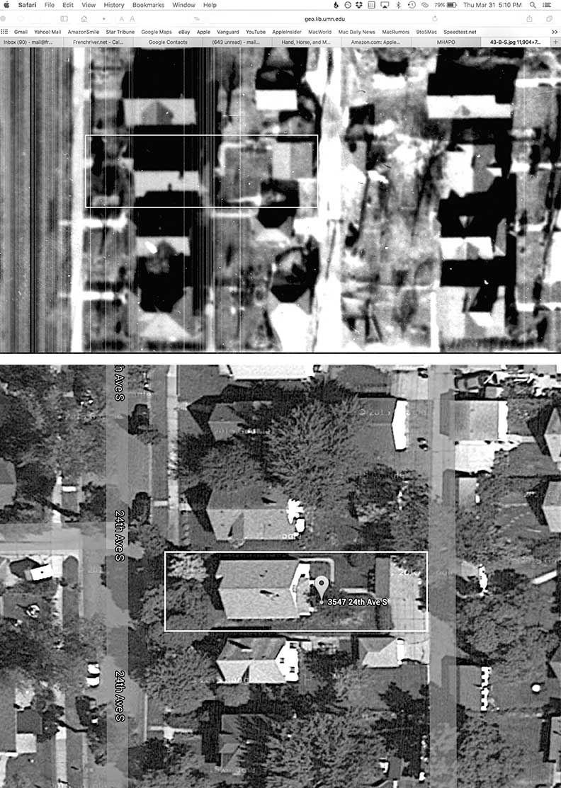
Aerial views of my bungalow in 1938 (top image) and today (lower image).
I searched the Borchert Map Library’s online images and found a 1938 aerial photo of my south Minneapolis neighborhood. It took a while to find my bungalow. It helps to pull up a current image of your neighborhood on Google Maps and then compare landmarks such as schools, parks, major roads, railroads and larger buildings on both images to help you zero in on your house in the historic photo.
Once I found my bungalow, I could see that the sidewalk leading from my bungalow’s back door to my garage once took a different route than it does today.
You can also view historic maps (no imagery) of Minneapolis and Saint Paul at bit.ly/239KcxC. The dates of the maps range from the 1860s to the mid-1900s.
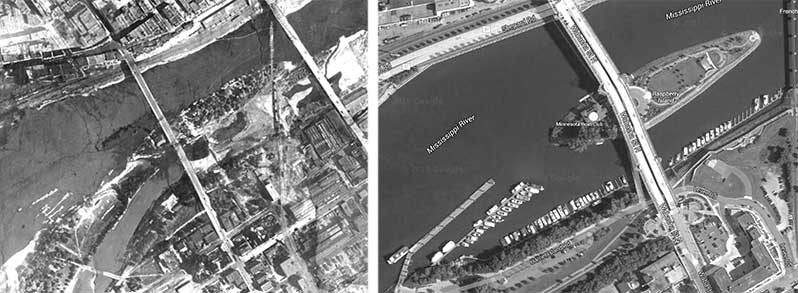
In 1923 (left image), the geography of the Raspberry Island/Harriet Island area of the Mississippi River, just south of downtown Saint Paul, looked much different than today (right image).